We are leading the effort to help land owners, Conservationists, Planners and Architects digitise their land in the Digital Age.
Our Mission
The Black Arrows wants to democratise access to accurate survey information.
We always challenge the status quo, and never default on the good old way of doing things. We use the latest technologies to save our clients’ time and budget, delivering key decision-making information professionally and safely. Ultimately, this makes the process of capturing and measuring your sites really simple and accessible to all.
Who we work with
From Oxygen Conservation, Nattegal, The National Trust, Savills, Plymouth City Council, to WYG and many more.
We work with thought-leading conservation organisations, architects, planners and developers, along with land owners themselves, to accurately capture sites, for use in pre-purchase evaluations, estate design and planning, as well as ecology, construction and marketing.
What we do
Capturing photos and accurate location data by drone and then processing it with specialist software, creates a data-rich 3D model of a site. With this 3D data, many diverse outputs can be created, from GIS and REVIT-ready Pointclouds, to Contour Levels, High Resolution 2D Maps, and much more.
“Daniel has been with us almost from Day 1 on our mission to scale conservation, and we couldn’t have hoped for a better collaborator, expert, and friend. Daniel is one of those few people genuinely enthusiastic and passionate about what they do and is always ready to go that extra mile. From his understanding of the project brief (which are always complex) right through to submission of high-end deliverables, Daniel just ‘gets it’ and is an absolute pleasure to work with. A consummate professional that I can’t recommend highly enough. I look forward to our next adventure!”
Benefits of 3D aerial surveys
48/72hr turnaround from flight to file delivery
Safe, Insured and Experienced drone operators
Normally just 20% of the cost and time of traditional surveys
Up-to-date view over satellite maps, which can be 5-10 years out of date
>15x detail over satellite and other mapping services
Demonstrating drone image quality verses Google Maps which in this case is also 3 years out of date.


Labelled contours produced to your need and specification.
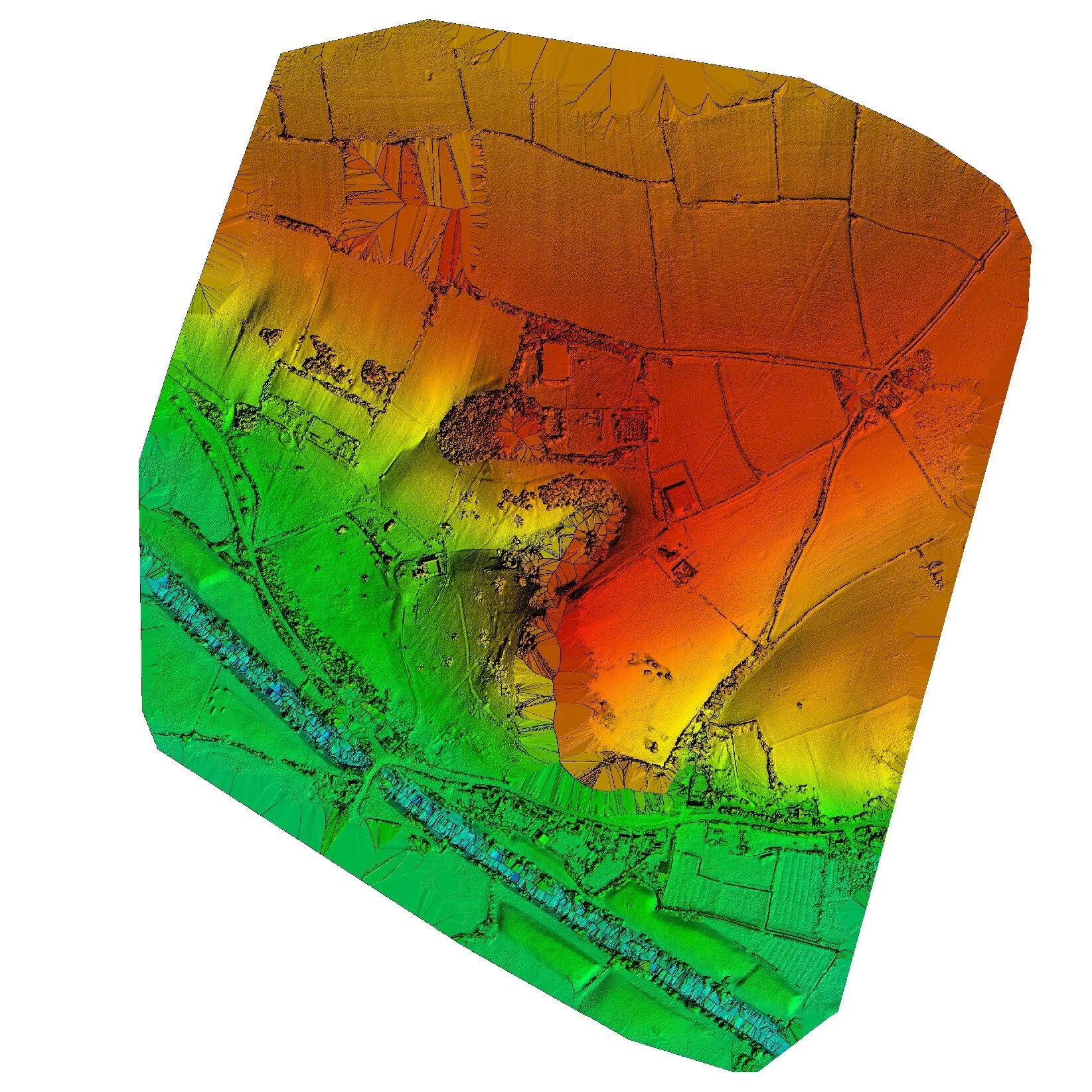
Digital Terrain Models and Digital Surface Models can be generated to help with planning and site evaluation.

A 3D Mesh Model and Pointcloud is generated which can then be used for measurement, and/or inserting your proposed new design.
PROJECT OUTPUTS
2D JPG images
Densified Point Cloud - LAS, LAZ, PLY, XYZ
3D Textured Mesh - PLY, FBX, AutoCAD DXF, OBJ, PDF
Grid DSM - LAS, LAZ, XYZ
Raster DSM & DTM - GeoTIFF
Contour Lines - SHP, AJF, AutoCAD DXF
Orthomosaic - GeoTIFF, Google Maps Tiles & KML
Applications
Conservation
Rewilding and Reforesting
Planning Permission
Pre-Purchase site evaluation
Roof Condition photography
Estate Management
Archaeology
Surveying & Mapping
Mining
Environmental Protection
Agriculture